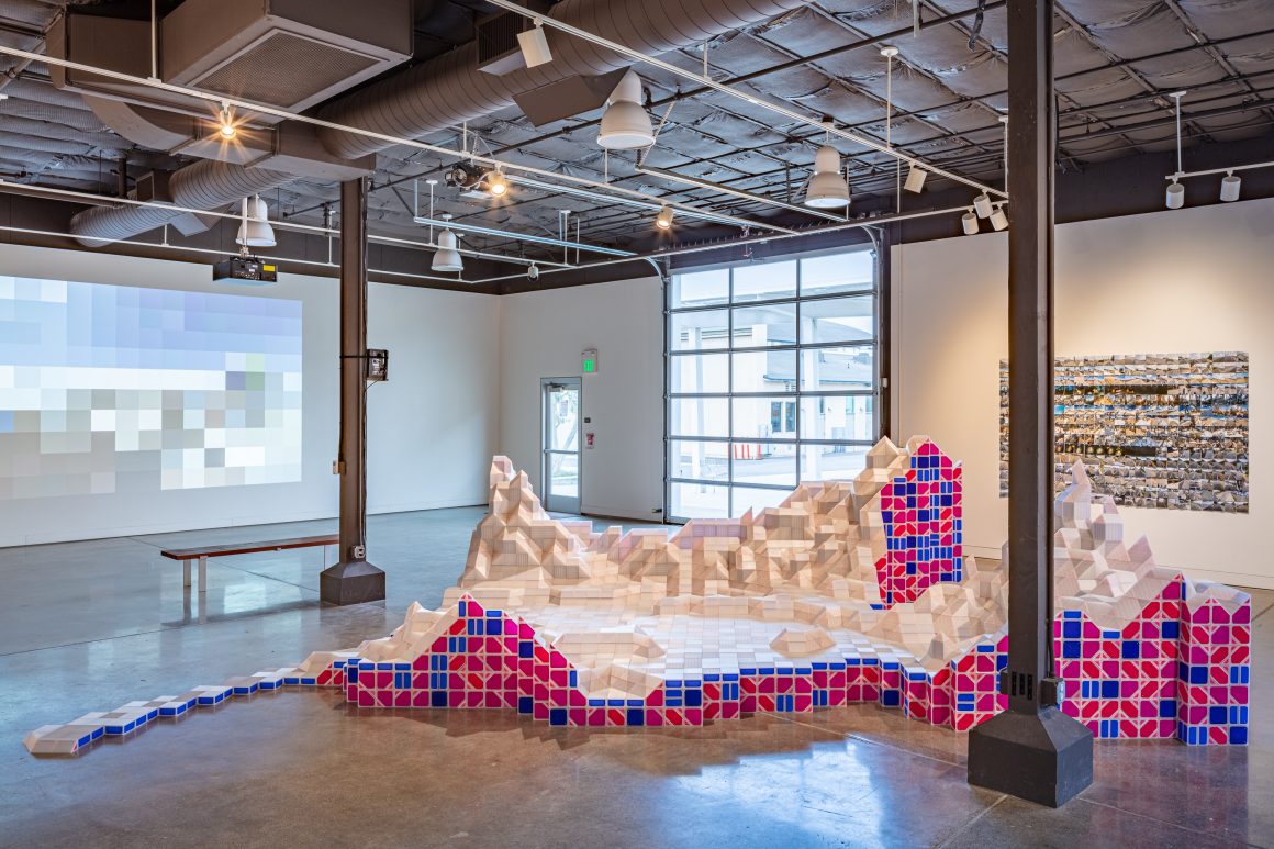
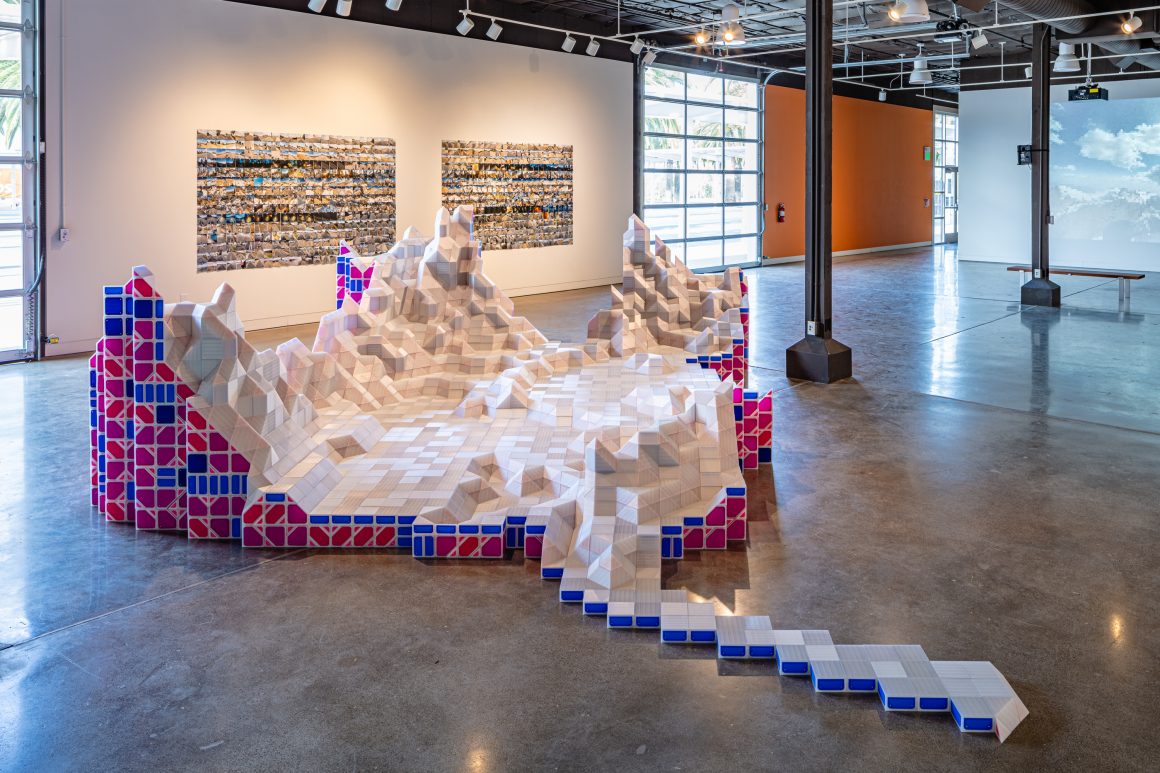
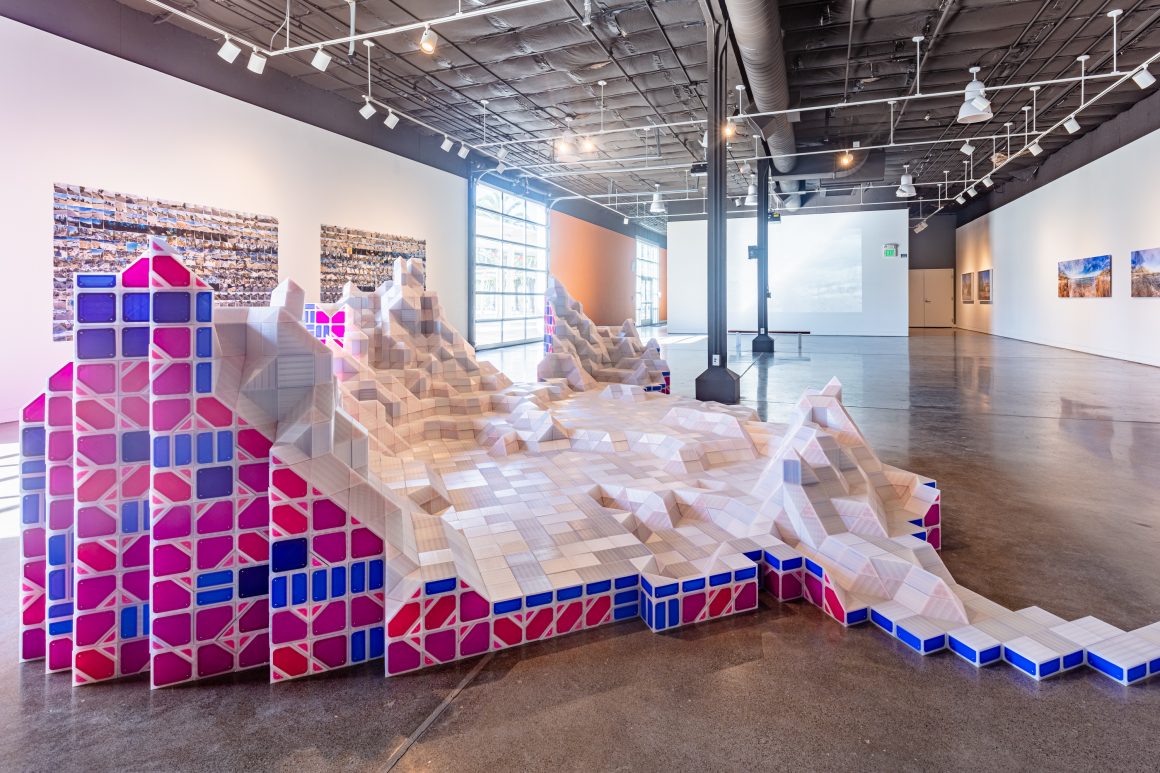
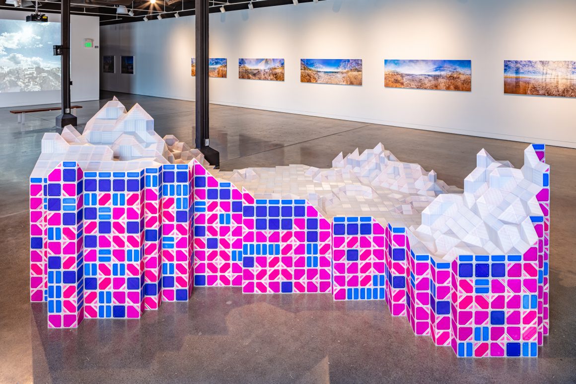
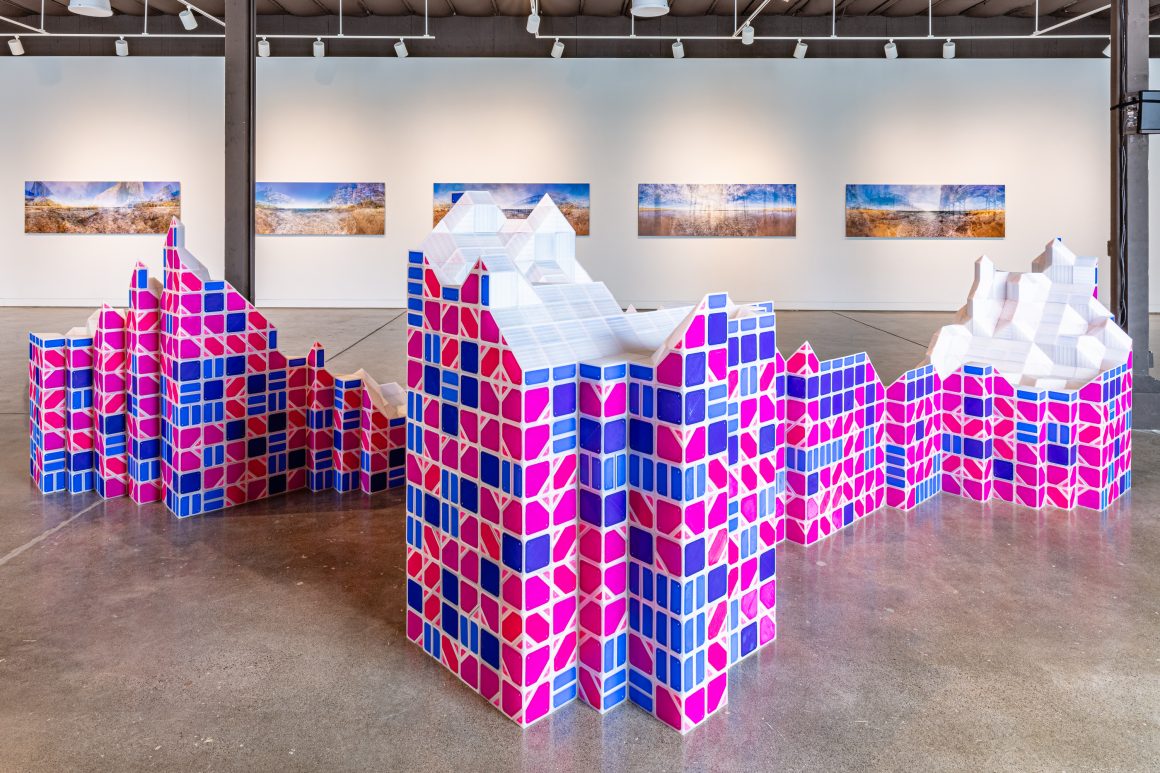
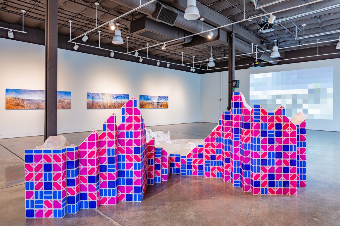
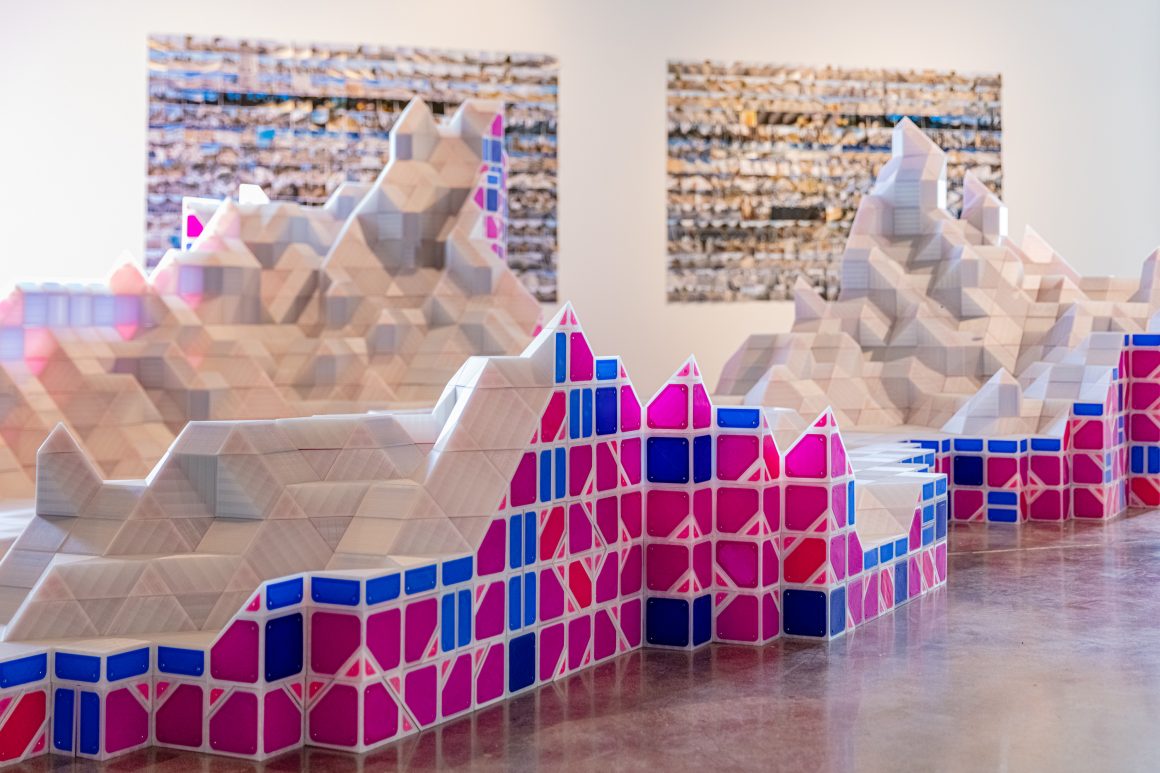
Orange County’s historic orange groves—such as those found at the Irvine Ranch, namesake of both City and Company—were irrigated by the Santa Ana River, which brings water from Southern California’s highest points to its current artificial outlet at the border of Huntington Beach and Newport Beach. Although the river organized the region historically, creating a fertile plain for the Acjachemen and Tongva peoples, today’s Orange County’s denizens are frequently unaware of the river and the way it connects them to a larger ecological network. One way to better understand a river’s true province is through its watershed, the bounded area of land that captures its water. As a new experiment in my ongoing Marching Cubes series of projects—sculptures assembled from a modular set of over five thousand 3D-printed components, derived from an algorithmic procedure of the same name—I have created Watershed #2: Santa Ana, a vertically exaggerated scale model of the territory that contains the river and reveals Orange County’s interdependence with the counties and mountains beyond.
Marching Cubes Watershed #2: Santa Ana
Floor assembly from modular components. 3D-printed PLA plastic, neodymium magnets, 58″H x 242”W x 160”L. Components 2016-2019, assembly 2020.